Yes! I was driving with my kids down I-35, and my daughter excitedly said, “It’s full on, all the way!” Driving with kids can be dangerous because they make me laugh.
I saw this cloud when it was either forming or dissipating. It looked something like above, but not quite as impressive. So, I can confirm that either the photo is legit or Shawn shot the actual cloud and touched it up to look more impressive, but I’d bet it’s legit.
I’m no meteorologist, but I believe the key is to look at the cloud bases of the surrounding clouds, which I believe are either cumulous or altocumulous (probably way off). Anyway, I don’t think this is a Cumulonimbus incus, because they grow from the cloud base up, and this one appears to be growing from the cloud base down (although I can’t see how tall this one is). I’m just assuming, because traditional thunderheads of that type do not commonly occur over Lake Superior on October 28. My theory is that it is a type of mammatus cloud (the ones that form the lumpy cloud bottoms during severe thunderstorms). My guess is that a cumulous cloud got too big for its britches, and once the convective forces keeping it aloft over the land no longer existed, the bottom literally dropped out, and a new cloud bottom was created using the new combination of atmospheric pressure, temperature and humidity existing over the lake.

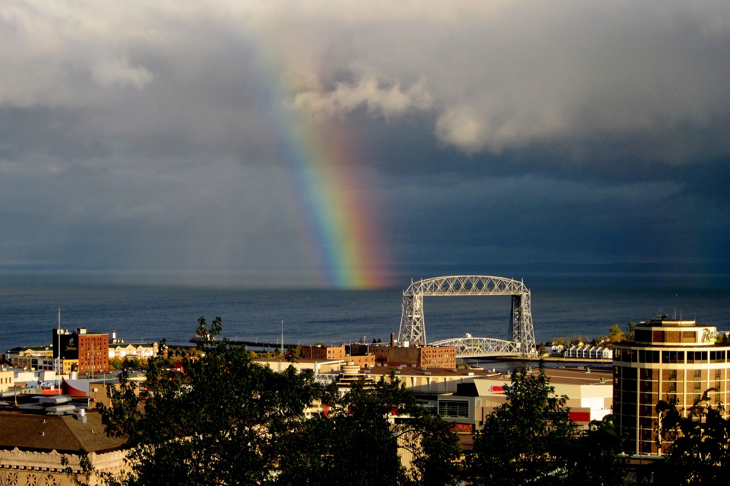
Oh yeah, I saw it from Barker’s Island. It was fully arched! Amazing picture Paul!
Yes! I was driving with my kids down I-35, and my daughter excitedly said, “It’s full on, all the way!” Driving with kids can be dangerous because they make me laugh.
Yep, I saw that as I was walking up First Avenue East downtown. It would have been better had I not been running late for work at the time.
We saw it just before we saw you at Carmody Paul. Coincidence or … not?
Definately not. Rainbows make me thirsty.
I got a nice pic near Schroeder, but since you make it so difficult to upload.
Duluth photographer Shawn Thompson snapped this on Oct. 28 — a different weather phenomena from a similar vantage point.
Is it just me, or does it appear that the aliens are getting ready to take over our city?
Is that a legit picture? I need a meteorologist to explain that one, please.
I saw this cloud when it was either forming or dissipating. It looked something like above, but not quite as impressive. So, I can confirm that either the photo is legit or Shawn shot the actual cloud and touched it up to look more impressive, but I’d bet it’s legit.
Cumulonimbus incus, perhaps?
I’m no meteorologist, but I believe the key is to look at the cloud bases of the surrounding clouds, which I believe are either cumulous or altocumulous (probably way off). Anyway, I don’t think this is a Cumulonimbus incus, because they grow from the cloud base up, and this one appears to be growing from the cloud base down (although I can’t see how tall this one is). I’m just assuming, because traditional thunderheads of that type do not commonly occur over Lake Superior on October 28. My theory is that it is a type of mammatus cloud (the ones that form the lumpy cloud bottoms during severe thunderstorms). My guess is that a cumulous cloud got too big for its britches, and once the convective forces keeping it aloft over the land no longer existed, the bottom literally dropped out, and a new cloud bottom was created using the new combination of atmospheric pressure, temperature and humidity existing over the lake.